Long before GPS, one man’s journey shaped how we see the world.
Fez – Before Google Maps made it possible to explore the world from our phones, cartography was an art that required bravery, intelligence, and an insatiable thirst for knowledge.
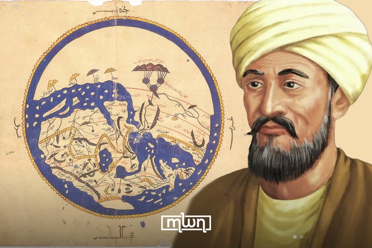
And guess what? The first truly accurate world map wasn’t created in modern times, it was drawn way back in 1154 AD by the brilliant Moroccan geographer Al-Idrisi.
But how did he manage such a feat?
There are three different accounts of how Al-Idrisi crafted his legendary map, each more intriguing than the last.
The First Theory: A king’s commission
Al-Idrisi, a geographer and traveler from the Moroccan city of Ceuta, found himself in the court of King Roger II of Sicily.
The king, fascinated by knowledge and exploration, commissioned him to create the most advanced world map of his time.
To achieve this, Al-Idrisi spent nearly a decade gathering data, sending out explorers, and compiling information from travelers, merchants, and previous geographical works.
The result? A silver globe depicting the world and a massive 70-section map that provided an astonishingly accurate view of the known world, so precise that parts of it remained useful even centuries later.
The Second Theory: 15 years of exploration
Some believe Al-Idrisi didn’t just rely on reports, he set out on an epic journey himself.
According to this version, he traveled for 15 years, exploring distant lands, documenting landscapes, and verifying geographical details firsthand.
His journey allegedly started in 1138 and concluded in 1153 when he arrived in Palermo, Sicily, with a map so groundbreaking that it challenged previous understandings of world geography.
Interestingly, his map placed south at the top, a common feature in medieval Islamic cartography but one that confuses modern viewers.
The Third Theory: A team of 12 experts
The final theory suggests that Al-Idrisi didn’t work alone. King Roger II, passionate about science and culture, provided him with a dream team, 12 experts specializing in navigation, mathematics, and cartography.
Together, they analyzed travelers’ accounts, interviewed sailors, and even sent out ships to explore uncharted territories.
One report claims that explorers returned describing a mysterious land where the sun barely rose and snow covered everything, likely Iceland or Greenland.
These discoveries further enriched the accuracy of Al-Idrisi’s map, making it a masterpiece of medieval geography.
Who was Al-Idrisi?
Al-Idrisi was not just a mapmaker, he was a scholar, scientist, and philosopher. Born into a noble lineage tracing back to the Prophet Muhammad, he excelled in various fields, from astronomy to medicine.
His work, particularly his book Nuzhat al-Mushtaq fi Ikhtiraq al-Afaq (The Book of Roger), remained a cornerstone of geographical knowledge for centuries, influencing European explorers during the Age of Discovery.
While we may never know exactly which of these theories is the most accurate, one thing is certain: Al-Idrisi’s contributions to cartography changed how we see the world, literally.
Read also: The Oldest Ceratopsid Fossil Ever Discovered in Morocco’s Boulemane


